Drone Services
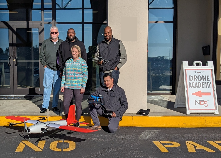
ND3 Drone Academy
The FAA requires any person that operates a drone for commercial purposes must have a Part 107 sUAS Pilots Certificate. Any person that is conducting wedding photography, real estate photography, construction surveying, or mapping must be licensed by the FAA!
There are many online courses to prepare one for the part 107 exam but there aren’t many that actually teach you how to fly! We have certified Part 107 and Part 63 Pilots on staff to train you for your first drone assignment, certification or recertification.
ND3 Drone Academy Teaches you:
•Basics of flight and FAA exam prep
•Basics of fixed wing and multirotor copters
•Standard flight control systems
•Basic photo and video editing and prep
•Autonomous systems and flight plan prep
•A combination of simulations and real flight time with certified instructors
Mapping/ Photogrammetry
At ND3, we have experienced pilots and advanced software ready to support your aerial mapping and photogrammetry needs. Whether you’re in Federal, State, or Local Law Enforcement, part of the Department of Defense (including Armed Services), or operating in the private or public sector—from commercial to residential applications—we’re here to help. The possibilities are virtually endless, and our drones meet or exceed industry standards for safety, precision, and quality. While not a complete list, read more for just a few ways we can assist.
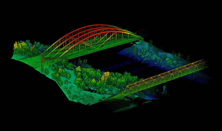
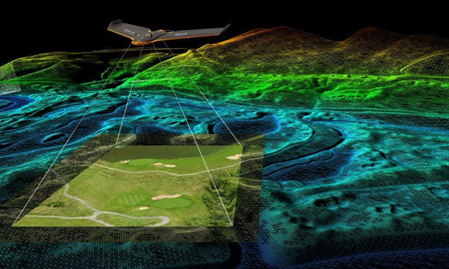
Aerial Mapping in Support of Your Construction Needs
Aerial mapping is a powerful tool that enhances construction planning, monitoring, and execution. By using high-resolution drone or satellite imagery, construction teams can obtain accurate topographical data, assess site conditions, and track project progress in real time. This technology improves efficiency by identifying potential obstacles, optimizing site layouts, and ensuring precise earthwork calculations. Aerial mapping also increases safety by reducing the need for on-site surveying in hazardous areas. Whether for land development, infrastructure projects, or large-scale construction, aerial mapping provides a cost-effective and reliable solution to support informed decision-making and successful project completion.
Survey quality products using ground control points(GCPs) and check points. (Can also bring in a 3rd Party licensed Surveyor)
GIS data deliverables compatible with industry standard formats for us in your heavy machinery
(TOPCON and Trimble Compatible)
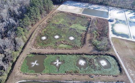

Aerial Mapping in Support of Disaster Relief
Aerial mapping plays a crucial role in disaster relief by providing real-time, high-resolution imagery that helps emergency responders assess damage, identify hazardous areas, and coordinate relief efforts efficiently. Using drones, satellites, and aircraft equipped with advanced sensors, responders can quickly survey affected regions, even in areas that are inaccessible due to debris or dangerous conditions. This technology enables faster decision-making, helping to locate survivors, direct aid where it's needed most, and support long-term recovery efforts.
By offering accurate and up-to-date geographical data, aerial mapping enhances disaster response, minimizes risks, and ultimately saves lives.
•We have long range birds that are able to immediately map an area after a disaster.
•We can share real time data* with first responders/Crisis management Centers.
•Can support responders in bringing first aid and basic life saving supplies to stranded civilians.
Aerial Mapping and surveillance in support of Law Enforcement
Aerial mapping and surveillance can also be of use in supporting law enforcement by providing real-time intelligence, enhancing situational awareness, and improving operational efficiency. Using drones, helicopters, and other aerial technologies, law enforcement agencies can monitor large areas, track suspects, and assess crime scenes with greater accuracy and speed. High-resolution imagery and thermal imaging help in search-and-rescue missions, disaster response, and locating missing persons. Additionally, aerial mapping aids in crime prevention by identifying high-risk areas and assisting in strategic planning. By leveraging advanced aerial surveillance, law enforcement can enhance public safety while minimizing risks to officers and civilians.
Inspections
We are partnered with QCC Services LLC to provide high quality corrosion/coating condition assessments, construction inspection, coating construction inspection, and drone services.
Chief Pilot Ryan Cox is a certified private pilot and certified part 107 sUAS Pilot with years of experience performing inspecting services.
QCC Services LLC Has qualified NACE CIP Level 3 staff and also teaches the CIP level 1 & 2 courses with over 20 years of construction inspection and 15 years of NASSCO certified SSES and I&I studies experience.
“PROTECTING TOMORROW, TODAY”
Technical 3rd Party Inspection
“What Could Possibly Go Wrong Watching Paint Dry?”
WHAT IS NACE?
National Association Of Corrosion Engineers
WHY IS NACE IMPORTANT?
Industry Leading Technical Education For Coating and Corrosion Expertise
WHAT CAN NACE DO FOR YOUR CONCRETE AND STEEL ASSETS?
Extend Coating Lifecycles With Advanced Assessment and Inspection Knowledge
ASTM D 3359 Method A & B Measuring Adhesion by Tape Test
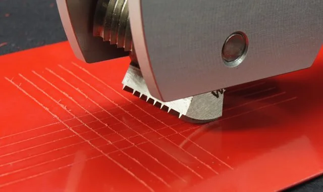
ASTM D 3359, Standard Test Method for Measuring Adhesion by Tape Test, describes two methods to measure adhesion by the tape test. Equipment Description Method A The only equipment required for Method A is a sharp knife and the special tape required to cause the pull-off. Method B Use a cross hatch cutter or a razor-sharp knife to score through the coating down to the substrate. Make a series of cuts at right angles to each other to form a grid of small squares. A range of cutting blades are available for different thicknesses and types of coating. Apply the tape as required by ASTM D3359 to the surface and remove. Visually assess adhesion by comparing the grid of squares against standards.
ASTM D 3359 METHOD A
Proper Use. Method A (Test Procedure) In Method A, an X cut is made in the coating film.
This method is used for coating films thicker than 127 μm or 5 mils.
ASTM D 3359 METHOD B
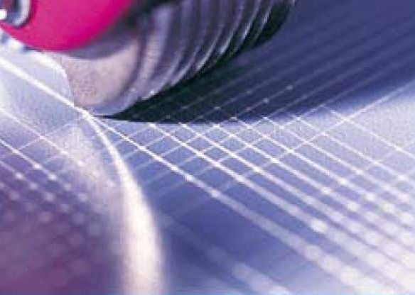
Method B (Test Procedure) Note: Test Method B is not considered suitable for films >5 mils (12 microns). Method B can be used above thickness greater than 5 mils (127 microns) if agreement between the purchaser and the seller is achieved and if wider cuts are used. If making the cuts individually: Make a series of cuts at right angles to each other. For films thinner than 50 μm (2 mils), make 11 cuts 1 mm apart in each direction. For coating films from 50 to 127 μm (2 to 5 mils) thick, make six cuts 2 mm apart at right angles to each other (Figure 19.9). If using the cross hatch cutting tool: Select the appropriate cutting blade, six or eleven, required for coating thickness. Press the blade to the surface, and pull the tool once in each direction to form a 90° angle grid.
Contact Us
Learn more about our capabilities, past work, and how we can help your organization achieve its mission.
